
Location
The Devon Meadows Precinct is located approximately 50km southeast of Melbourne’s central business district and covers an area of about 261 hectares, generally bounded by the South Gippsland Highway to the north and east, Worthing Road to the south and Craig Road to the west.
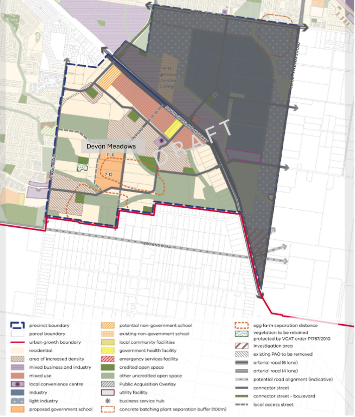
View the image in fullscreen.
Precinct structure plan
The Victorian Planning Authority (VPA) is leading the preparation of a Precinct Structure Plan (PSP) for the Devon Meadows Precinct, working in partnership with the City of Casey, state government agencies and service authorities.
This PSP is included in the City of Casey’s Vision for Remaining Growth Areas.
Infrastructure funding
Infrastructure within the precinct will be funded by contributions from landowners. The Infrastructure Contributions Plan (ICP):
- identifies the location for schools, community facilities local parks and roads
- establishes a framework for the collection of funding for infrastructure and services
- ensure the cost is shared between the various developers and the wider community.
More information
For more information about the Devon Meadows PSP, please contact the Victorian Planning Authority Casey Fields South (Employment) and Devon Meadows - VPA