Where the plan applies
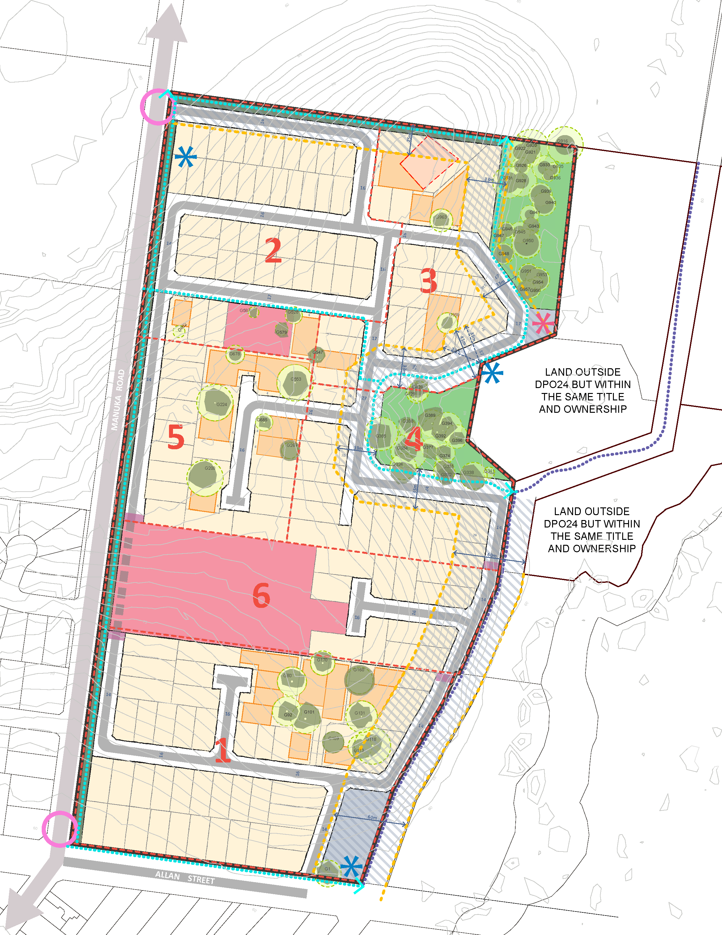
The Manuka Road Development Plan includes land bound by Manuka Road (west), Allan Street (south) and the Cardinia Creek Regional Parklands (north and east).
The below image can be viewed in fullscreen.
Overview
The 2026 Manuka Road Development Plan was adopted by Council on 26 May 2026. The adopted Development Plan was finalised in response to submissions during the community consultation process, feedback received from referral agencies and further refinements raised by Council officers.
The purpose of the Development Plan is to:
- provide a framework for the future development of the Manuka Road Precinct
- accommodate around 150-160 residential lots
- provision of new open spaces and paths for recreation
- protection of heritage sites and significant vegetation.
Any future planning permit applications lodged under a Development Plan Overlay must be generally in accordance with an adopted Plan and would be exempt from public notice and third-party review rights.
The traffic impact assessment for 42-80 Manuka Road, Berwick has also been completed.