
What is flooding
Storms and floods are natural hazards. Factors such as climate change, urban development, and aging infrastructure contribute to increased flood risk. It is important to recognise that flooding cannot be completely prevented, especially in older or well-established urban areas.
Types of flooding
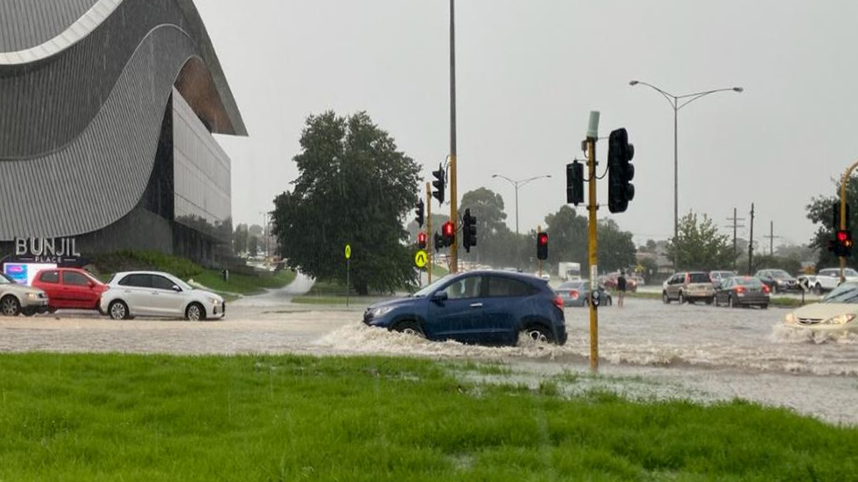
Stormwater flooding: This occurs when heavy rainfall exceeds the capacity of the stormwater drainage system. The system includes parts such as pits (underground water collection points) and pipes that transport rainwater away. If the system cannot handle the heavy rainfall, water overflows onto streets and surrounding areas. Stormwater flooding is most common in built-up urban areas.
Waterway flooding: This type occurs when rivers and creeks (natural flowing watercourses) overflow due to heavy or prolonged rain. It is most common in areas near rivers, creeks, and floodplains (flat land areas near waterways that naturally flood), where excess water has nowhere to go.
Coastal flooding: This occurs when high tides, storms, or rising sea levels push seawater inland. It affects beaches, coastal towns, and low-lying shorelines.
Flood management responsibilities
Flood management responsibilities are shared by Melbourne Water, councils, State Emergency Services, and other key partners.
Melbourne Water is the floodplain management authority for the Port Philip and Westernport region. Melbourne Water is responsible for:
- regional drainage (large open drains or pipes that service land areas, called catchments, that are larger than 60 hectares—a hectare is about the size of a standard sports field—and creeks)
- floodplain and waterway management.
Casey Council manages and maintains local stormwater drainage systems that service catchments of less than 60 hectares. The Council also applies building and planning controls to developments to address and mitigate flood risk.
The Department of Transport and Planning is responsible for some stormwater drainage systems on arterial roads and freeways.
Property owners are responsible for the drains and pipes that collect stormwater on their property, including those that run under the footpath and nature strip. These are part of the private stormwater drainage system.
The State Emergency Services, Melbourne Water, and Council are involved in emergency response, flood planning, and community education.
To be emergency prepared and stay informed about incidents and warnings, you can:
- Visit VICSES for the City of Casey Local Flood Guide and Flood & Storm Emergency Plan.
- Download the VicEmergency app or visit emergency.vic.gov.au.
Managing flood risk in the City of Casey
The City of Casey has many naturally flood-prone, low-lying areas. With more frequent extreme rain and denser development, flood risk is increasing.
While all flooding cannot be prevented, Council is working to reduce flood risk for the community by:
- upgrading drainage infrastructure where possible
- maintaining Council’s drainage assets
- employing non-structural solution such as land-use planning controls, flood warning systems, and community education.
Flood mapping
Under Regulation 148 of the Building Regulations 2018, Council is required to prepare mapping for areas under its control that are liable to flood. Melbourne Water is also working with Councils across Victoria to update flood maps for the Greater Melbourne area.
The City of Casey is committed to ensuring the community has access to accurate flood information. This is achieved through the regular review and updating of Council's flood maps. These maps show areas that may be affected during rare, significant rainfall events, known as 1% Annual Exceedance Probability (AEP) storms—meaning a 1% chance of such an event in any year.
These events are irregular. They may occur more than once in a given year, or there may be several years without such an event.
How flood maps are used
Flood mapping is a vital tool for managing and reducing flood risks. Flood modelling helps predict where water would spread and how deep it would reach in the event of heavy rain or waterways overflowing.
The governments and emergency services use this information for:
- planning infrastructure and transport networks
- supporting flood warning systems, evacuation planning, and emergency management
- guiding long-term urban growth and resilience strategies management
- identify whether a property is at risk of flooding and provide advice to property owners
- planning flood mitigation projects.
For individuals and communities, flood maps provide valuable insights into local risks and support planning and preparation. This includes identifying safe evacuation routes and locating suitable emergency shelters.
Additional Information
To request specific flood information for your property, you may apply to obtain a Property Information Certificate from Council.
Before a building permit, you may need a flooding application if the land is prone to flooding.
Before applying, talk with the private building surveyor who will issue the building permit. Exemptions may apply.